Anyone who’s ever worked with light-level geolocators knows that the analysis can be messy. But our latest study highlights that the tags can provide much more information than just spatial estimates.
Just about every bird nerd I know loves a good tracking study.
As tracking tags have gotten lighter, we’ve been able to deploy them on more and more species. The movements they have uncovered have confirmed suspected migratory routes in some cases and completely flipped those expectations on their head in others. But regardless, the information we gather from tracking tags are both exciting to read about and invaluable to protecting migratory birds.
That is, when they work as intended. As an Outreach Biologist for Audubon’s Migratory Bird Initiative, part of my job was to communicate with migration researchers about their data. One thing this task illuminated was that, for every published tracking study, there are a handful of tags that malfunctioned, provided poor location estimates, or were lost entirely.
Yet, the other thing this project highlighted is that there is a large community of researchers behind these research efforts, all with slightly different perspectives and skillsets. In our recently published paper, we showcase the power of leveraging different perspectives across this network to ask a variety of questions and get the most out of these tracking datasets.
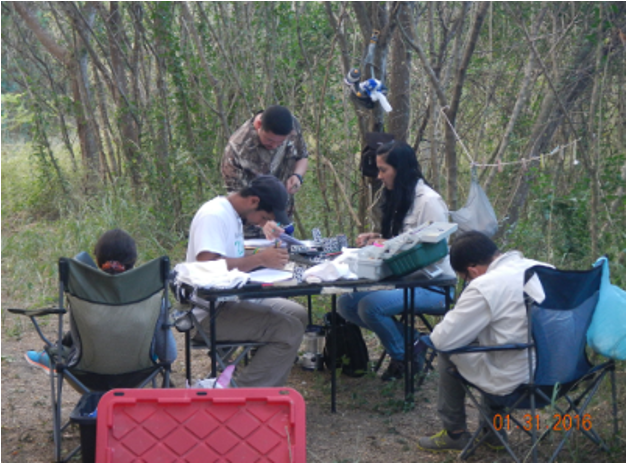
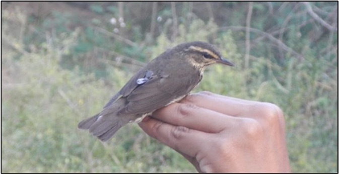
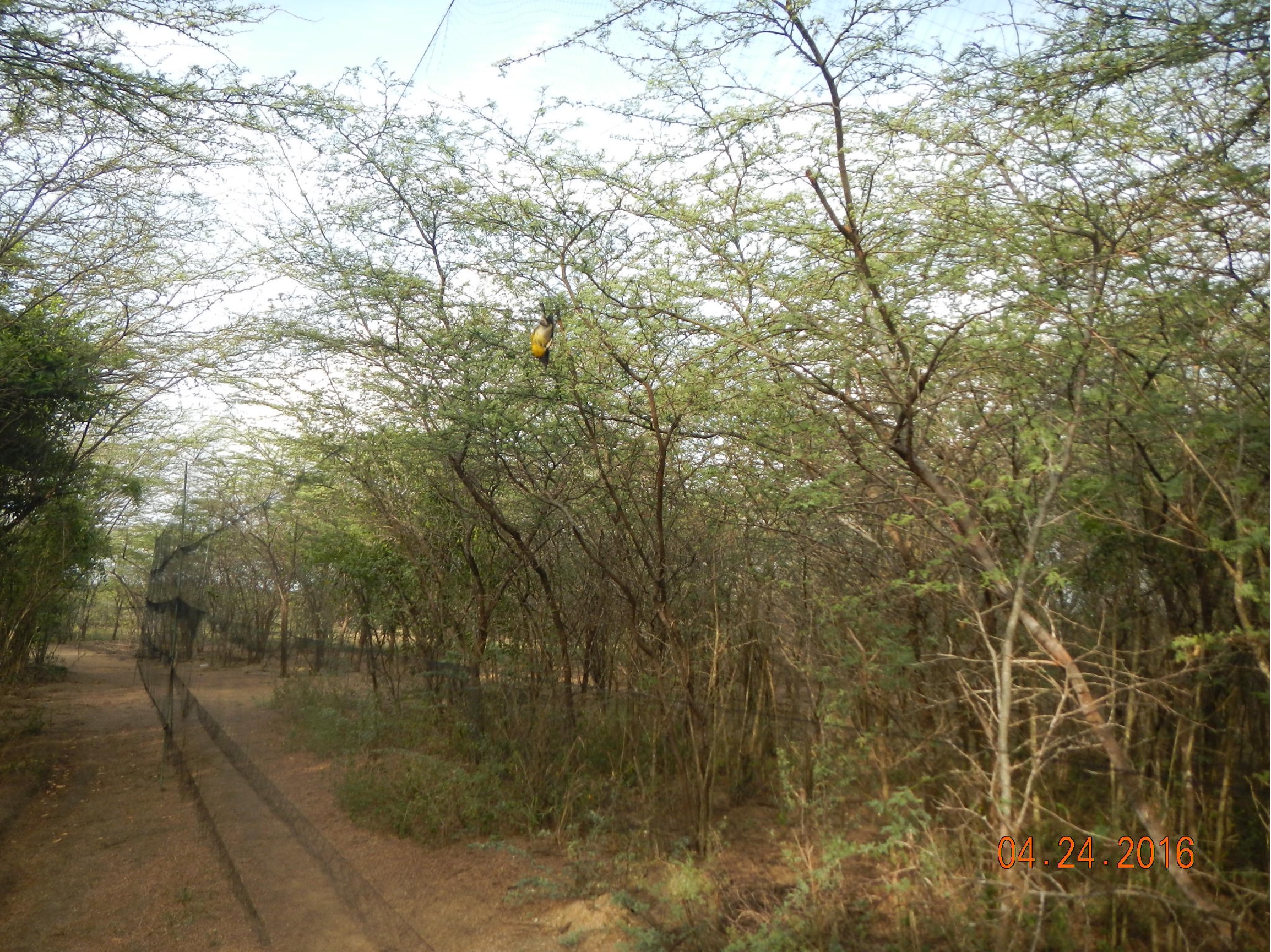
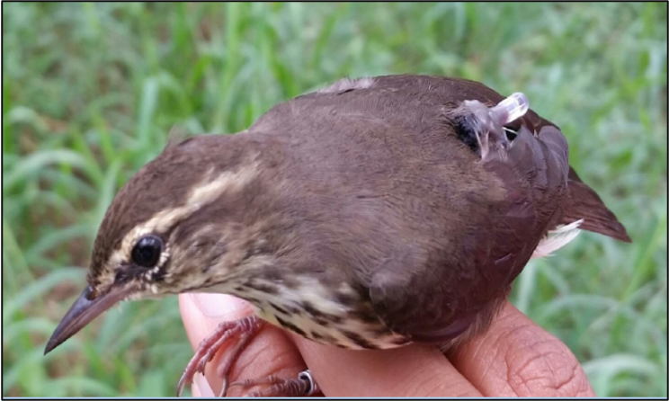
For two years, Fred Schaffner and Ivelisse Rodríguez-Colón deployed light-level geolocator tags on Northern Waterthrushes. While many tracking efforts deploy tags on the breeding grounds, they deployed their tags on non-breeding birds at their field sites in southern Puerto Rico. Through their field work, including mist netting that began in 2011, Schaffner and Rodríguez-Colón developed an intimate understanding of Northern Waterthrush wintering ecology and their intention for tracking the birds was to uncover where they migrate and breed. Yet, as they began retrieving the tags, they came to a realization that just about all other light-level geolocator users have: interpreting the location estimates can be messy. Light-level geolocators determine locations based on light readings and dense vegetation or skulky bird behavior can cause shading effects that make location estimates challenging. These birds move out of the mangrove canopy, across open water and into the dry forest understory every morning to feed, then returning to the mangrove canopy to night roost.
As two migration ecologists who have used the tags extensively, Michael Hallworth and Nat Seavy are no strangers to those challenges. They had dealt with these shading issues before. Moreover, having worked with these data in different contexts, they were aware of the information that light level geolocators could offer beyond location estimates.
The combination of close field observations and a large toolbelt of analysis approaches served as the strength of this study. Through months of group discussion and trial and error, we were able to extract coarse location estimates and determine that the Northern Waterthrushes tagged in Puerto Rico likely stopped in the northern Greater Antilles before migrating along the eastern coast of North America to breed in the northeastern United States and northern Quebec.
But beyond spatial information, we were able to derive so much more demographic and phenological information about these birds. For example, using carefully collected field data, we were able to determine that recovery rates for tagged birds were much higher during the dry season. By visually annotating light level signatures, we were also able to approximate the spring departure date and breeding site arrival for each bird. Perhaps most exciting, we were even able to identify incubation periods from dark periods in the light signatures. This not only allowed us to identify these birds as females, which can be difficult for a monochromatic species like the Northern Waterthrush, but also provided information on nesting phenology.
Ultimately, we hope that our study can serve as an example of all the different information that can be inferred from geolocator tags. As mentioned above, many researchers I contacted while working for The Migratory Bird Initiative have retrieved tags but are under the impression that their data are unusable. We show that even when location estimates are messy, geolocator data can be used in creative ways to study demography, phenology, and other pieces of information that can help piece together full annual cycles. This also highlights the importance of archiving data so they can be re-analyzed as new methodologies are developed.
More broadly, this paper was truly a collaborative effort across the ornithological community. Each author brought pieces of information that were vital to the final product. Our hope is that any researchers struggling to make sense of tracking data will take advantage of the large network of migration scientists across the ornithological community to make sure we are getting the most information we can to protect the birds we all love.
Mikko Jimenez
The results of this study were recently published in the Journal of Field Ornithology:
Schaffner, F. C., M. T. Hallworth, M. F. Jimenez, I. Rodríguez-Colón, and N. E. Seavy. 2023. Light-level tracking of Northern Waterthrush (Parkesia noveboracensis): lessons learned from wintering ground deployments. Journal of Field Ornithology 94(4):5. https://doi.org/10.5751/JFO-00369-940405
Header photo: Northern Waterthrush (Parkesia noveboracensis). Photo by Carol Hamilton | Getty Images
